By Jenny Howell
Special to the Tribune
Time has changed over the last two months. I would guess I’m not the only one to notice this. Do you remember that far distant past, clouded in the mists of time, when we could host friends for dinner and plan adventures, all constantly busy, planning, rushing and running from one thing to the next?
Some have continued at that pace to keep the rest of us going, and for them I’m sure time is as it has always been, but many of us have had a big slowdown in our lives to match the ‘lockdown that isn’t a lockdown’ here in B.C., and time seems to have also correspondingly slowed. It looks like shortly we will be revving up again; distantly and differently, but at an increasing pace nonetheless. As we get out and about more and can cautiously increase our connectivity, it seems a good time to publicize a project the Conservation Society has been working on for the last while.
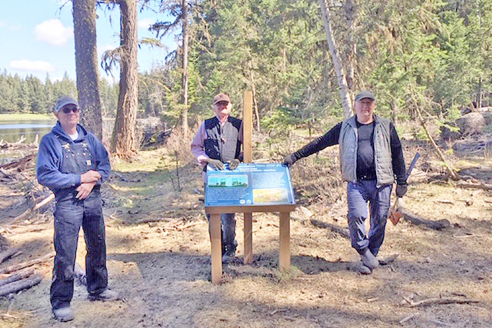
With thanks to our partners (see below) and CCCS volunteers, we have now put the finishing touches on the new ‘hydrology’ trail. This is a beautiful walking trail in the community forest that meanders around two small ponds, with eight interpretive signs along the way that explain the relationship between individual trees, forests and the planet’s water, and provides a chance to learn some Shuswap water and forest words.
READ MORE: Snow science at Gavin Lake
When schools are able to run field trips again, this will be a new offering to add to our current list of Water Wise and Waste Wise programs, and CCCS staff will incorporate activities and games based around the theme of each sign to enrich and enhance the content.
In the meantime, it is a great place just to explore and enjoy the area. The trail is easy to find (see below) and takes about 45 minutes at a gentle pace with stops at the signs. Look for the small green arrows on the trees to help guide you; the only tricky spot is a left turn onto a smaller trail as you follow the shoreline of the second, larger pond, but keep the basic concept of circumnavigating the pond in mind and you will be fine.
The recent situation has highlighted the interconnections and webs between us all; some with positive outcomes (sharing recipes and online gatherings) and some less so (watching the virus spread extensively around the world in three months). We hope this trail gives you the chance to combine a nice walk with further insight into the ecological connections which support all life.
Directions to the Hydrology trail: Turn right on Hodgson Road off Highway 20. Continue on Hodgson approximately five kilometres. Turn right on Bysak Road, and park in the gravelled parking area just beyond the hydro lines. The trailhead is on the right, leading into the forest. Look for the green arrows.
Thanks to our partners in this project: Williams Lake Indian Band, Williams Lake Community Forest, Pacific Salmon Foundation, Northern Shuswap Language and Culture Society.
Water Wise Tip: Improve water quality by protecting shoreline vegetation; replant areas lacking trees and shrubs with native species.
Jenny Howell is the Water Wise instructor and the executive director with the Cariboo Chilcotin Conservation Society.
Do you have a comment about this story? email:
editor@wltribune.com
Like us on Facebook and follow us on Twitter.