Jim Hilton
Special to the Tribune
In my search for recent satellite images of last year’s fires, I was informed by Ann Morrison from FLNRO in the Inventory Branch that there were free images from a USA site, “https://glovis.usgs.gov.”
For those interested in obtaining a wide variety of images I recommend you take the time to familiarize yourself with the site. It has online tutorials and is reasonably easy to use. I will provide some instructions about obtaining the August 2017 images that I was able to download.
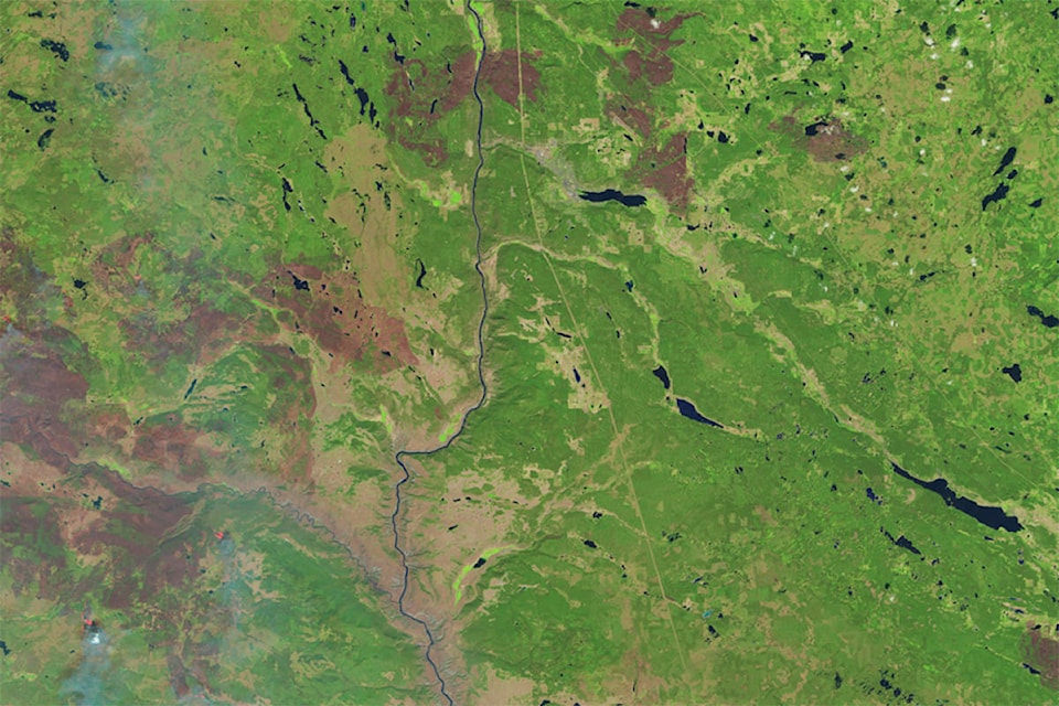
After you bring up the “glovis” site follow the instructions and take the tutorial. You will eventually need to register before you can download any material. After you find your way around go to the general areas of interest - in my case the Williams lake to Hanceville area of the Chilcotin. Since I was interested in the most recent images of the fires, I set the time filters from July to Dec 2017 and minimal cloud cover. Go to the bottom of the list of satellite choices i.e. Landsat 1 is the oldest and Sentinel -2 is the newest. When you apply your search criteria it will show if there are any images in the area and a copy will appear on the screen if there is one available. Keep adjusting your criteria to see if you can get clear coverage for your area of interest.
READ MORE: Williams Lake Mayor reflects on ups and downs of the 2017 wildfires
After you register and get email confirmation you are ready to download. I suggest you create a special wildfire file to keep track of the images. You also have to be familiar with the .zip procedure as some files are large enough that the images are sent in zip format. For example the image I found very useful covered the fires around Williams lake, Riske Creek and Hanceville was around five mega bites. I eventually downloaded a 750 mb file (it took 30 minutes to download it on my system) which provided much more detailed information. For example, it showed all the new fire guards around the wildfires. To open the larger files you will need FREE software used in Europe from the following site. http://earth.esa.int/SAFE/ and http://step.esa.int/main/toolboxes/sentinel-2-toolbox/
I was also able to download wildfire information for all of the Elephant Hill fire and some information for the Plateau and Gustafson fires but nothing so far for the Precipice (Kleena Kleene) fire.
VIDEO: Wind and warm, dry weather increase Elephant Hill widlfire
I admit to being a bit of a geek when it comes to remote sensing data so I have no problem encouraging anyone interested to start using some of the material listed above.
The images are local, recent and free along with free software to work with the information. I have paid more than a thousand dollars for software which is not as good as the free material you can get today. There are excellent tutorials and help sites for anyone who likes to learn on their own with a little help.
I will also talk to some local business about leaving some files there to see if they will print images for anyone who wants to get a example of the images available. There are also lots government sites that allow a reasonable amount of free downloads of many kinds of base maps, forest cover maps and forest related information.
With the free software and a little practice the sky is the limit on the availability of remote sensing information that is out there.
Do you have a comment about this story? email:
editor@wltribune.com
Like us on Facebook and follow us on Twitter.