Skip to content

VIDEO: Williams Lake river valley 2020 flood repairs continue

The Tribune toured the area on June 10, 2021

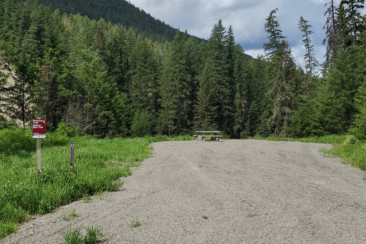
Williams Lake river valley trails will not be re-opened to the public this year as crews continue remediation work due to last year’s flooding.

“It will be closed down while we do construction because it is still dangerous,” said the city’s chief administrative officer Gary Muraca. “The section from Comer to Tolko we hope to have that part done by the end of the summer as well as the mountain bike bridge that riders use to come over from the west-side.”

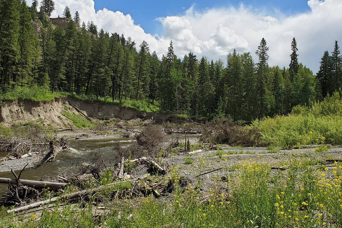
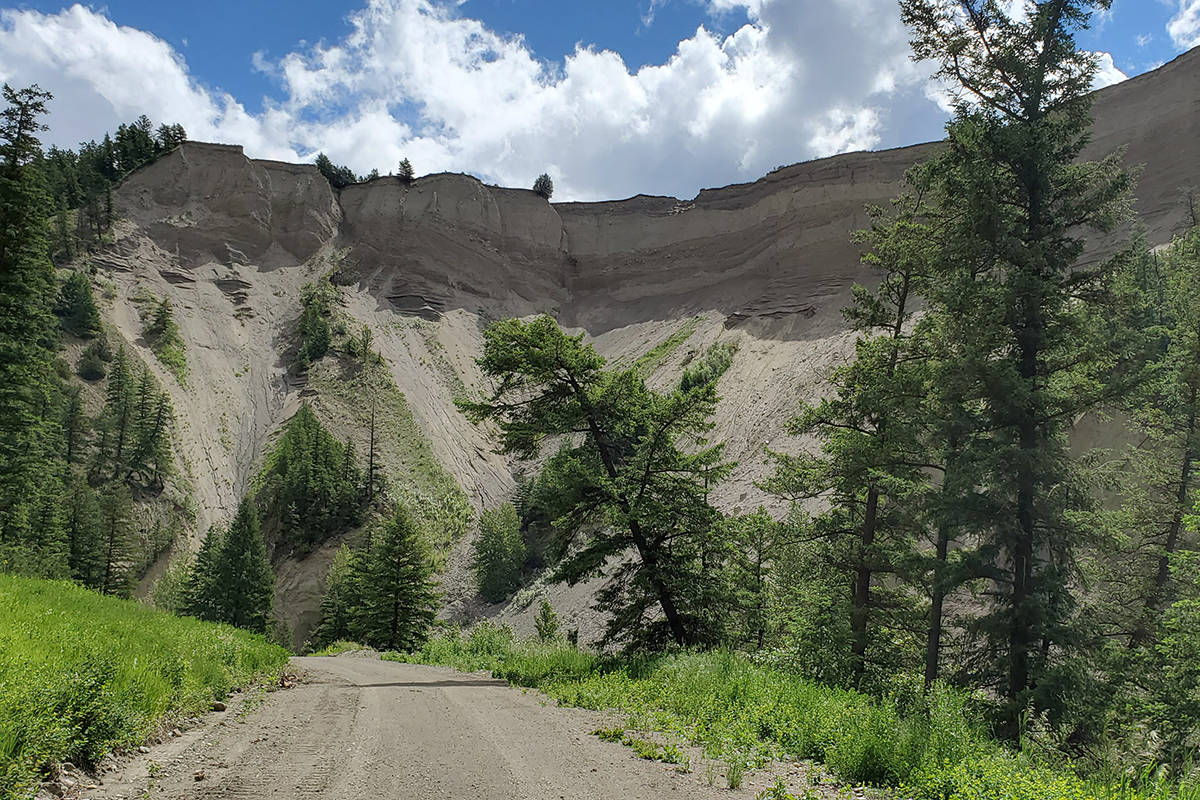
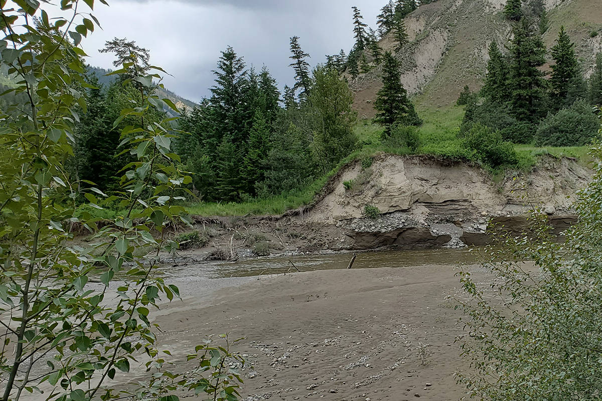
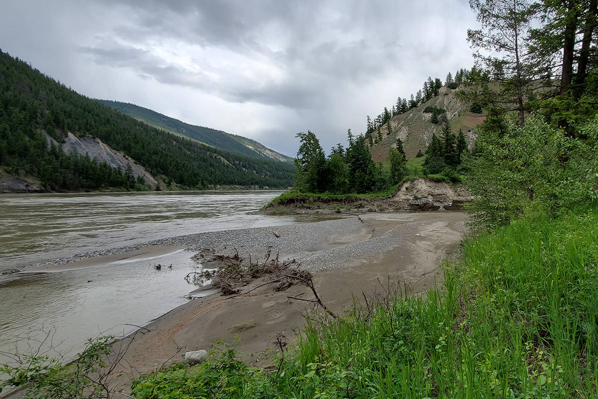
In April 2020 the Williams Lake River reached 200-year levels, taking out bridges, parts of the road, widening some sections of the creek and damaging the city’s sewage infrastructure.

During a tour of the area on Thursday, June 10, from the Comer Street parking lot all the way to Tillion Indian Reserve No. 4 at the Fraser River, the Tribune was able to see work that has been completed.

“We’re out of the emergency phase and into recovery now,” said the city’s chief administrative officer Gary Muraca, noting $12 million was spent on the emergency phase and another $8 million will be spent now on recovery.

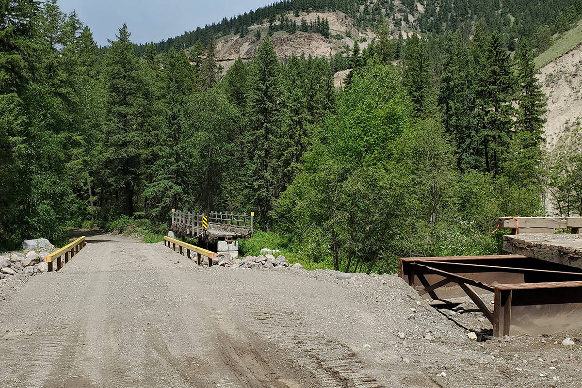
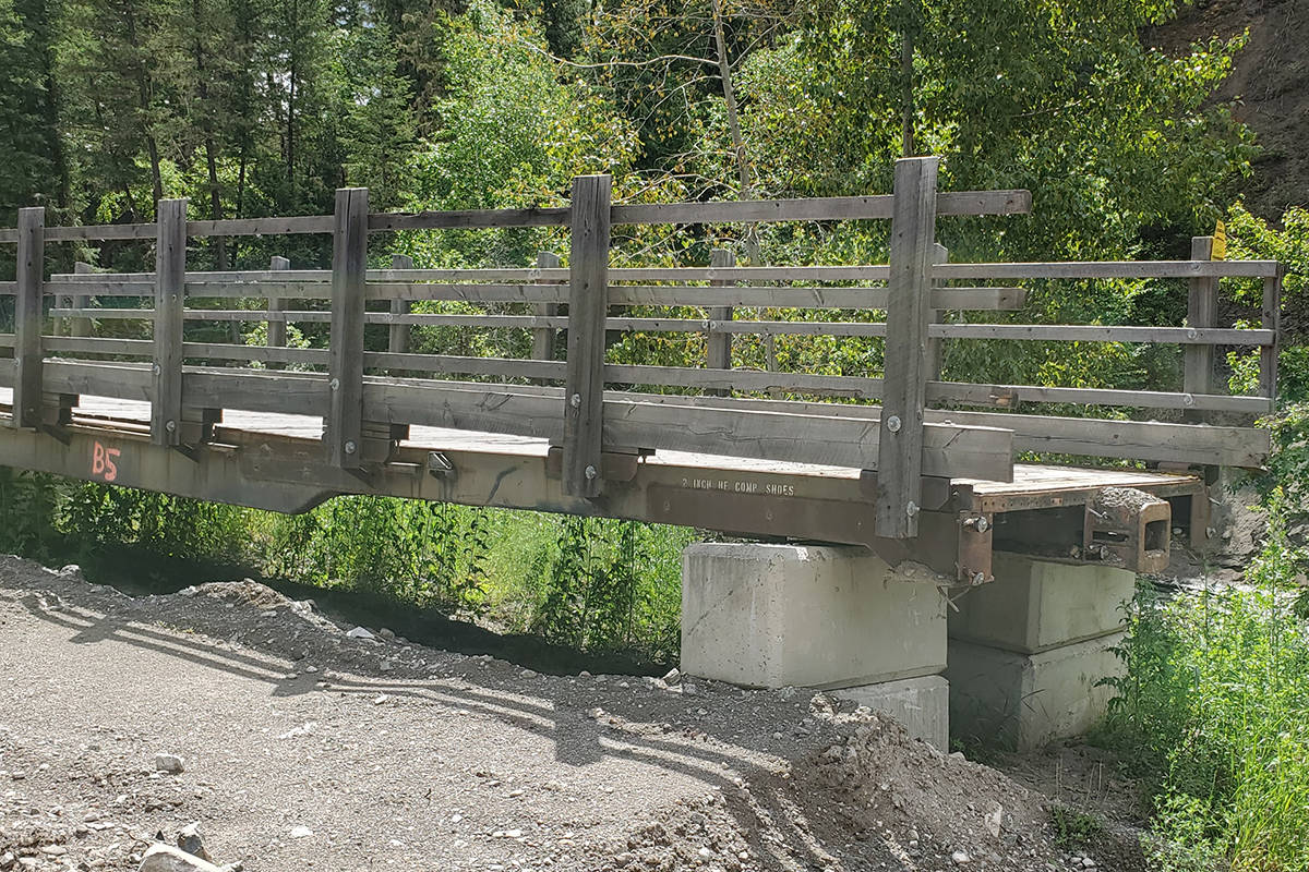
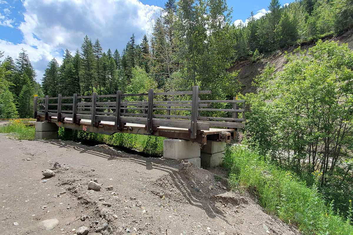
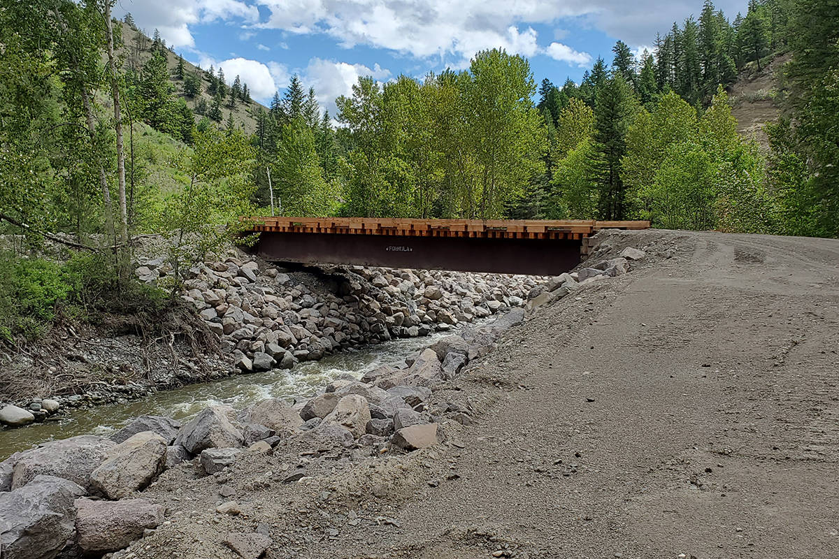
The city purchased 14 bridges that are in place, but still need to be put on permanent abutments which will be done by city crews and contractors.

Muraca said the city will be selling any of the old rail car bridges that are salvageable.

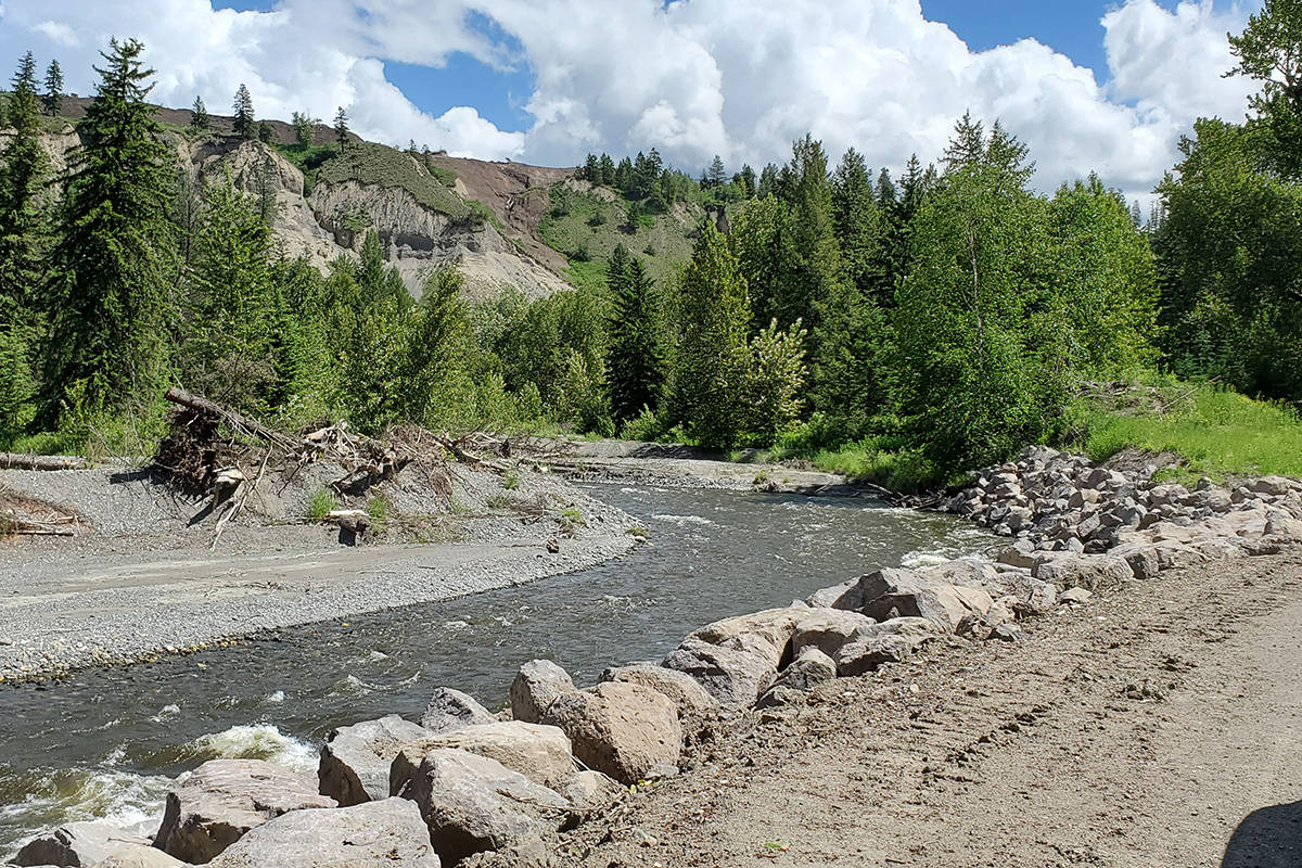
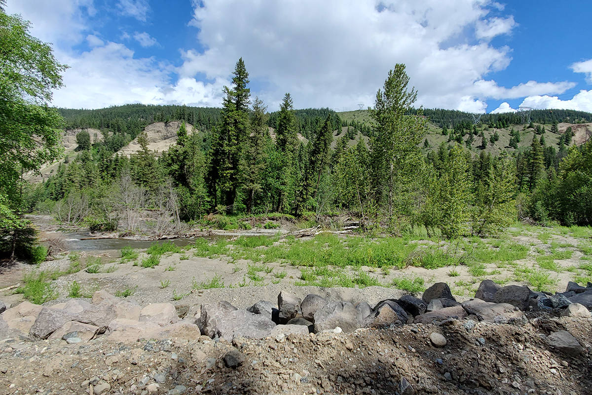
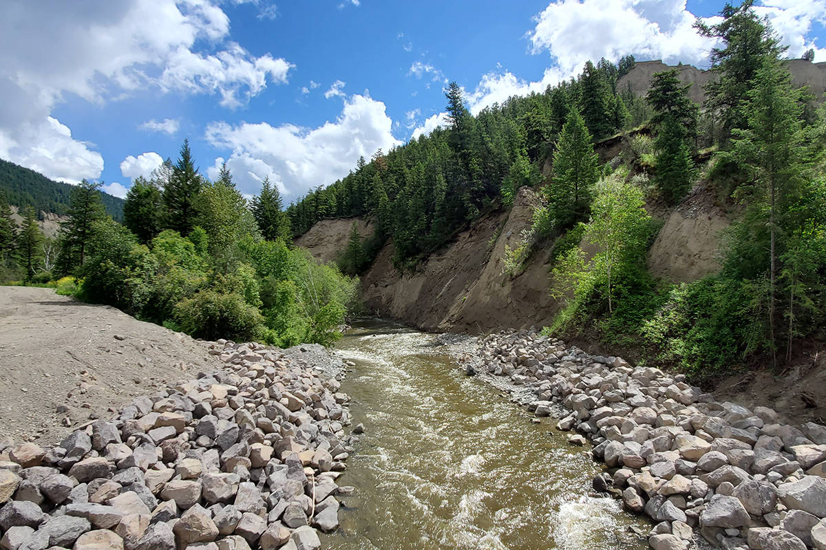
Parts of the road are much higher above the creek than they were prior to the flood and all of the bridges will be above the 200-year-flood level as well.

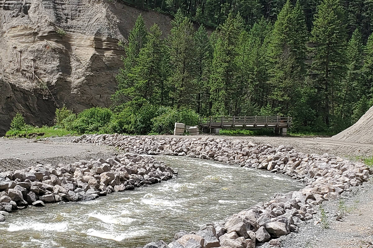
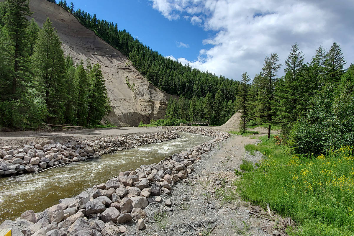
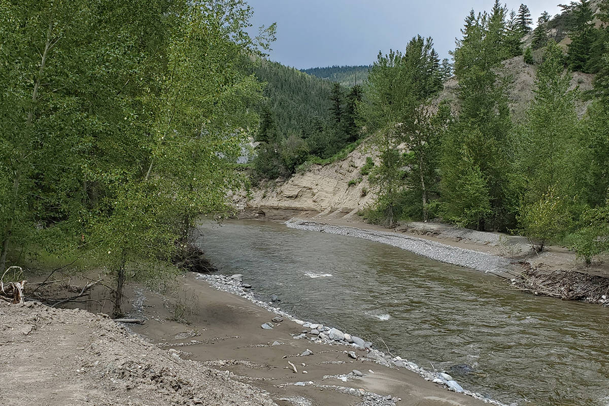
In many instances the road has been rerouted, the river’s banks have been rip-rapped and a portion of the river has been realigned to pull it away from the slopes.

Muraca said the $20-million project will take some time to get all the work completed.

“Everybody will realize it will actually better than it was previously, and hopefully we will get everybody down here enjoying the river valley soon.”

Whitney Spearing, Williams Lake First Nation manager title and rights, said Sugar Cane Archaeology was able to complete its site assessment of the Tillion Reserve area although a large portion was lost due to erosion caused by the flooding.

“The site we were looking at was on the opposite side of the bank where the road goes toward beach area on the Fraser River,” she explained. “Hopefully it stabalizes, with the work the city is doing upstream, and all of the flood plain mapping that they are doing.”


news@wltribune.com

Like us on Facebook and follow us on Twitter

25473454_web1_210617-WLT-RiverValleyTourJune2021_2
Williams Lake river valley June 10, 2021. (Monica Lamb-Yorski photo - Williams Lake Tribune)
25473454_web1_210617-WLT-RiverValleyTourJune2021_3
Williams Lake river valley June 10, 2021. (Monica Lamb-Yorski photo - Williams Lake Tribune)
25473454_web1_210617-WLT-RiverValleyTourJune2021_4
The landscape was altered when the Williams Lake River reached 200-year-levels and flooded the area in 2020. (Monica Lamb-Yorski photo - Williams Lake Tribune)
25473454_web1_210617-WLT-RiverValleyTourJune2021_5
Williams Lake river valley June 10, 2021 view of new and old bridges. (Monica Lamb-Yorski photo - Williams Lake Tribune)
25473454_web1_210617-WLT-RiverValleyTourJune2021_6
An old rail car bridge will be sold. (Monica Lamb-Yorski photo - Williams Lake Tribune)
25473454_web1_210617-WLT-RiverValleyTourJune2021_7
Another surplus bridge that has been replaced. (Monica Lamb-Yorski photo - Williams Lake Tribune)
25473454_web1_210617-WLT-RiverValleyTourJune2021_8
The banks of the Williams Lake River have been rip-rapped extensively. (Monica Lamb-Yorski photo - Williams Lake Tribune)
25473454_web1_210617-WLT-RiverValleyTourJune2021_9
A view showing how wide the creek bed was widened during the flooding in 2020. (Monica Lamb-Yorski photo - Williams Lake Tribune)
25473454_web1_210617-WLT-RiverValleyTourJune2021_10
Another view of work done to fortify the river. (Monica Lamb-Yorski photo - Williams Lake Tribune)
25473454_web1_210617-WLT-RiverValleyTourJune2021_11
A view of what locals call the ash tray. (Monica Lamb-Yorski photo - Williams Lake Tribune)
25473454_web1_210617-WLT-RiverValleyTourJune2021_12
One of the new bridges will need to be permanently installed with an abutment and handrails. (Monica Lamb-Yorski photo - Williams Lake Tribune)
25473454_web1_210617-WLT-RiverValleyTourJune2021_13
Another view of how the area was altered due to the flooding. (Monica Lamb-Yorski photo - Williams Lake Tribune)
25473454_web1_210617-WLT-RiverValleyTourJune2021_14
This area shows where there was a bridge installed by the Ministry of Forests when drivers came down Frizzi Road that is now about 200 metres wide due to last year’s flooding. (Monica Lamb-Yorski photo- Williams Lake Tribune)
25473454_web1_210617-WLT-RiverValleyTourJune2021_15
Where the Williams Lake River enters into the Fraser River at Tillion Reserve #4. (Monica Lamb-Yorski photo - Williams Lake Tribune)
25473454_web1_210617-WLT-RiverValleyTourJune2021_16
The Rotary Club of Williams Lake will be developing a picnic area where the Mission Trail ends on the west side. (Monica Lamb-Yorski photo - Williams Lake Tribune)


Monica Lamb-Yorski

About the Author: Monica Lamb-Yorski

A B.C. gal, I was born in Alert Bay, raised in Nelson, graduated from the University of Winnipeg, and wrote my first-ever article for the Prince Rupert Daily News.
Read more