It’s been quite a week here in the Cariboo Chilcotin which is coping with a one-in-two-hundred-year flood event.
Erosion in the Williams Lake River Valley continued Tuesday as crews attempted to repair a ruptured sewer pipe and save the access road into the City’s sewage treatment infrastructure where damage has occurred due to flooding.
Read More: Williams Lake contractors armour sewer lagoon, averting potential large sewer breach
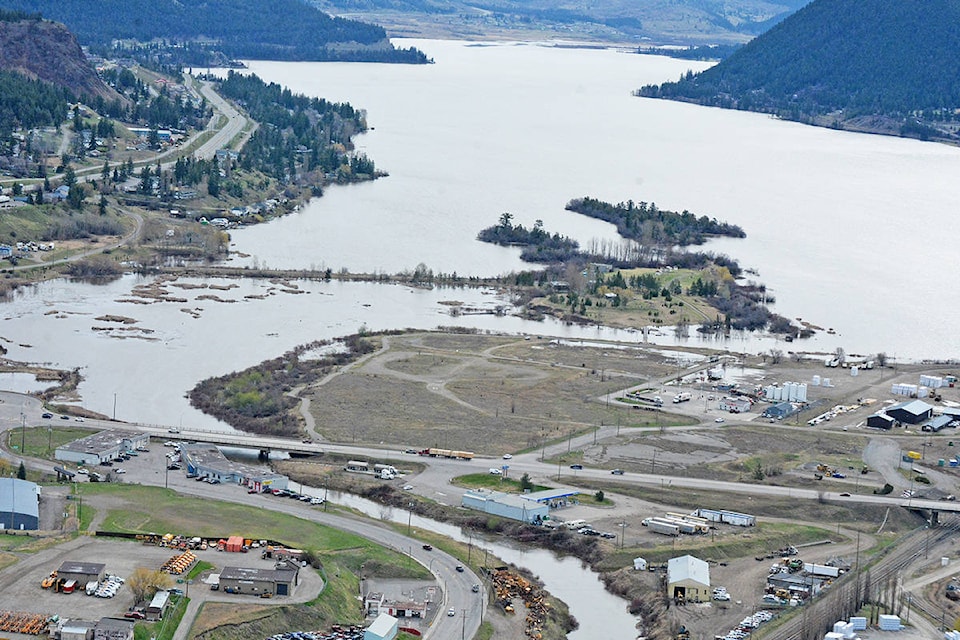
In the past week, flooding has wiped out several bridges in the Williams Lake River Valley, which is bearing the brunt of the force.
Gary Muraca, the City’s director of municipal services said he hiked into the area Monday from a new approach and saw a number of slides that had not been noticed previously.
“Thank God for cooler weather,” he told the Tribune Tuesday morning. “We hope to make some progress today.”
On Sunday, the City asked residents to reduce water use to slow the flow of sewage through the system after the pipe break. Saturday morning, April 25, the province approved emergency funding for up to $550,000 which allowed the city to start moving forward with the repairs.
The plan Tuesday was to enter the river valley from the Moore Mountain side in the west by ATV and get into the lagoon area.
“We want to start draining that vulnerable cell, that is being eroded, over to another that has capacity,” Muraca said.
“We want to ensure if that cell is eroded it won’t drain into the river.”
Read More: Aerial tour of flooding in Williams Lake area
Muraca said the contractor will keep working on the roads to gain access to the sewer lagoons so the necessary repairs can be made to the infrastructure that is already compromised.
Muraca noted that the level of Williams Lake dropped four inches in the last 48 hours.
“That’s the good news,” he added. “Hopefully that trend continues.”
Above the river valley, an evacuation order remains in place for 11 industrial properties on Frizzi Road due to erosion of the bank below.
An evacuation alert has also been issued for the Green Acres Mobile Home Park. The mobile park’s 86 homes are not under imminent threat, but residents are advised to prepare for the possibility of having to leave at a moment’s notice.
Additionally, the Scout Island causeway was another worry for the City, Muraca said, noting they are watching it carefully and have closed it to vehicle traffic due to rising water levels.
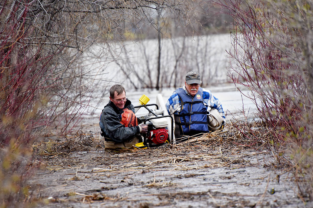
Williams Lake Field Naturalists volunteers were busy Friday and Saturday, April 24 and 25, trying to protect boardwalks and the wooden pedestrian bridge from extremely high water.
On Saturday morning, April 25, Ordell Steen, Ray Hornby, Don Lawrence and Ken Day secured two large water containers onto the bridge and pumped them full of water to try and weigh down the bridge which has become unstable from the flooding.
On Thursday, April 30, Lawrence said the bridge was still stable and in good shape, and the water was receding.
The City called a seven-day state of local emergency Friday, April 24. The state of local emergency has been extended for the City of Williams Lake another seven days.
Do you have a comment about this story? email:
editor@wltribune.com
Like us on Facebook and follow us on Twitter.