The 40,000 hectares owned by the Department of National Defence in the Chilcotin continues to be used as a training area, while measures are being taken to protect and preserve the area’s grasslands.
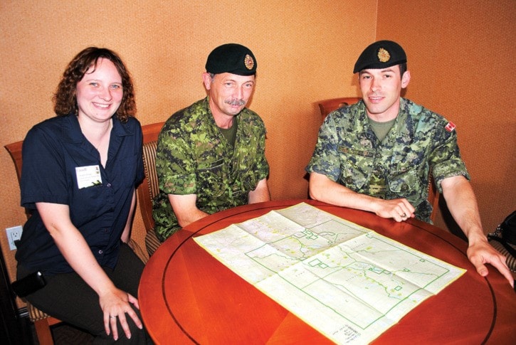
At an open house in Williams Lake on June 19 at the Coast Fraser Inn, the public had the opportunity to meet biologists, natural resource technicians, and two members of the military to hear firsthand how those two efforts coexist.
National Defence acquired the land in May of 1924, after negotiations began to exchange a parcel of land it owned in Vancouver’s Point Grey area, presently UBC Endowment Lands.
“The process began in 1912 with an Order in Council authorizing the exchange of Federal Crown Land with the Provincial Crown Land, and was completed on May 10, 1924,” said Mike Harrison, property officer, Area Support Unit Chilliwack.
Over the years DND has used the site for winter and summer training, and the officer training program ran courses from the mid-1970s to 1990s.
In addition, Search and Rescue from Vancouver Island and troops from Edmonton, Chilliwack, Kelowna and Vancouver area all use the site for training, Harrison added.
Warrant Officer Martin Brink, 1 Combat Engineer Regiment Edmonton, said his unit hasn’t trained in the area since 1996, but will be returning in late September with 500 to 600 people for a three- to four-week training exercise.
Some will arrive by army vehicles, others by buses - part of the training
“We haven’t been in a green environment for a long time. There’s not much green in Afghanistan,” he said.
His regiment has invited some infantry personnel to join in, as well as service battalions.
“Every year we have to train together and meet certain expectations around working together,” Brink explained.
Truck drivers will help move bridging and equipment to certain areas and need to be included in the plans.
Infantry also has to be included, because it serves as protection when the engineers are building a bridge.
“They are going to be doing patrols, number one making sure there’s no cows coming in the area while we’re building, or two, if it’s a real enemy. If we see cows, we’d call them in as refugees,” Brink said.
Before they can actually blow up a bridge while training, there are standing orders to conduct a four-kilometre search of the area around the blow area.
Brink said they’ve carried out several base cleanups over the years as well. Rules have changed and it’s expected.
“We’re going to be blowing things up like engineers do and because we know civilians go into the training area and cows go in there, if we blow a hole in the road, we have to fill it in. We don’t have a choice.”
Natural resource technical officer Angela Manweiller has worked for DND since 2005 and is based in Chilliwack.
“I work with species at risk and invasive species, working with other organizations to maintain the training area in a natural state. One of our big goals is sustainable terrain so the area is always good for training and for others,” she said.
Manweiller is a civilian — there is no environment trade in the army, she said.
“Our section is all civilians. If you look at the army environment program there are a lot of things we deal with. Noise, anything that can be considered the environment, air, dust, and fires.”
In fact, the 2010 Meldrum Creek Fire burned a quarter of the training area, she said.
“Now they’re actually doing salvage logging in there. Trees on the training area are managed by Aboriginal Affairs and Northern Development Canada. Anything that comes out of there is for the benefit of the First Nations. Whatever profit is made goes back into managing the forest.”
Manweiller described the training area as a huge migratory bird pathway.
“Environment Canada is doing research in the area on Burrow’s Goldeneye and installing transmitters on ducks they’re tracking in the training area,” she said.
Water quality testing is done annually, to measure the effects of global warming and track what’s in the water to determine what water bodies are safe to drink from.
“There are a lot of metals in the soils in this area and there are quite a few water bodies that are not suitable for livestock to drink from,” she said, pointing to an area on a map that’s big for cattle use where some of the water has been contaminated by fecal coliform.
The water quality fluctuates with the seasons, and anytime NDN does testing, the information goes out to local ranchers. “I believe seven different ranchers have rights to our training area. Part of the Becher Prairie is in the training area too, “ Manweiller said.
Another display showed that over a 30-year period a third of the grassland was lost to encroaching forest cover, some of that due to fire suppression.
Since 2007, Area Support Unit Chilliwack has partnered with Aboriginal Affairs and Northern Development Canada to support ecosystem restoration.
“To keep it open we’ve been cutting down the smaller trees that are moving into the grasslands. We were considering prescribed burning, and we’re going to have one this spring, but it didn’t happen because of the weather,” Manweiller said.
They have also hired local First Nations to cut trees under 20 centimetres that are growing in the grasslands and have restored 1963 hectares of grasslands and removed 2.9 million small trees.
University of Saskatchewan biology professor Karen Wiebe has been returning to the area every summer for the last 15 years to study the Northern Flicker.
“We have a tent camp in the bush, behind the old firefighting camp. We’re biologists studying flickers out on the military land, but we aren’t connected with the military.”
Over the last 15 years, Wiebe and graduate students have been involved in a long-term project, catching and colour banding about 150 pairs.
They track reproduction all summer to see which Flickers return each year.
“We put radio transmitters on the juveniles to measure survival rates and where they move on the landscape. One student is looking at how the level of food provisioning affects nestling growth, colouration and corticosterone levels, which is a stress hormone.”
Flickers are migratory and fly south to California, migrating back in the spring. A 2009 natural resource inventory of Drummond, Lye, Greer, Roundup and Jackson Lakes, determined the most common species in the area are Lesser Scaup, Barrow’s Goldeneye and Bufflehead.