Welcome to this edition of Haphazard History where you can choose to listen to the first ever audio version of this popular column by Barry Sale. Thanks to Heartland Toyota and Jason Ryll of Front Row Voiceovers for making this first podcast of Haphazard History possible. Click on the podcast link further down in the story, and enjoy!
The iconic bridge over the Fraser River some 25 kilometres west of Williams Lake on Highway 20, sometimes referred to as “the gateway to the Chilcotin” has an interesting and colourful history.
For eons, a natural slowing of the current in that area of the river made for a suitable crossing site. When the river is at its normal height, the current is usually peaceful enough for boats to cross, and when the flow of water is low, there are spots where animals can easily swim across.
Prior to European settlement, there was a substantial Secwepemc village located at the mouth of Chimney Creek about 8 kilometres upstream from the present bridge site. The people there constructed log rafts, which they used to cross the river. In the early 1800’s, Hudson Bay Company fur traders and trappers were ferried across the Fraser on these rafts, which they referred to as barges. The Indigenous People there became known as “the People of the Barge”, and are referred to as such fairly often in the journals of Fort Alexandria from the 1820’s through the 1850’s.
With the coming of the gold rush in the early 1860’s, one of the most common routes to the goldfields was via the River Trail from Lillooet, which paralleled the Fraser River on the more level west side. There were crossings at Canoe Creek or, further up river at Chimney Creek and trails led east to the diggings.
The Chimney Creek trail led east from the river, through Chimney Valley, up and over the ridge to St. Joseph’s mission and 150 Mile House, then northeast to Quesnel Forks and Keithley Creek. A side branch split off this route at what we now call the Pinchbeck Hill and made its way into the settlement of Williams Lake.
Early in 1862, Amadee Isnardy, a young man from France, arrived in Chimney Valley and pre-empted land alongside the trail. He constructed a roadhouse and a saloon and cleared land for a farm. There, he and his wife, the daughter of a chief of the Stl’atl’imx nation in Lillooet, raised 6 children. By the mid 1880’s Isnardy had pre-empted or purchased virtually all of the land in the valley.
In the mid 1870’s with the gold rush over, there was a land rush of sorts to the rich agricultural grasslands of the Chilcotin. Settlers moved steadily into the area, but few of the stayed on, finding the winters especially too harsh.
Those who did remain put down roots, establishing some of the historic ranches that still exist today. At this time, Soda Creek was the major town in the area, and the main route to the Chilcotin was to cross the river on the Soda Creek ferry, then to follow the river south before moving inland to come out at Becher’s Prairie.
A crossing at or near Chimney Creek was shorter, but considerably more difficult, canoeing across to the west side and then having to travel up a steep, rocky hillside to the top, after which there was a fairly flat and easy run to Becher’s Prairie.
Amadee Isnardy, seeing a good business opportunity, began a ferry boat operation across the Fraser in the late 1880’s. His “ferry” consisted first of a large freighter canoe, and later of a 6 by 12-foot scow, both of which were rowed across the river. To transport freight wagons on the scow, first the wagon was unhitched and loaded on, then the horses were led into the water and pulled by their halters behind the ferry as it crossed.
Isnardy’s eldest son, Joe, took over the ferry operation for a few years before selling it in 1900 to Murdock Ross. Ross was an ex-schoolteacher from Nova Scotia, who had settled on the west side of the river. He was a big man, over 6 feet tall and weighing better than 200 pounds. He had to be – rowing back and forth across the river was backbreaking work. For this work he received an annual government stipend of $500. Murdoch served as the Chimney Creek ferryman until 1904 when the first bridge was completed.
That first bridge began with a petition to the government in Victoria, writing in 1898 by Fred Becher and signed by all 40 eligible voters in the region. They argued that such a bridge would bring prosperity to the Chilcotin and thus to the province. Surprisingly the government of the day agreed and, by 1901, preliminary studies were done, and a site where the river narrowed downstream from the ferry site at the mouth of Chimney Creek, was chosen for the crossing.
The bridge was a unique design, featuring a lower cable and counterweight to provide rigidity and to overcome wind lift and movement common to suspension bridges of the day. It had a 325-foot span with wooden towers on each end. On the west side, there was a long wooden approach trestle with a similar, but shorter, one on the east side.
The stone piers on both sides of the river were built by a crew led by Louis Boitano, a professional stone-mason and cousin of Augustine, who had established a ranch at Springhouse. Louis had come out from Favale, Italy to visit his cousin, and he stayed to work on this project. The stone footings, constructed out of large granite blocks, were so well built that they are still standing today, 120 years later.
In the late summer of 1902, work began on the bridge structure itself. The materials were shipped by rail to Ashcroft, then hauled to the construction site by horse teams pulling wagons in the summer and sleighs in the winter. There were up to 60 workers employed on the project, most of them local and unskilled.
The huge 700 foot cables had to be shipped using large wagon convoys. Roads were poor, and at some points, non-existent. It was a massive undertaking, built in September of 1904, the bridge was finally completed. The total cost was $65 thousand, almost double the original estimate.
This new bridge was referred to by several names at first. The official government title was the Chimney Creek Bridge, even though it was several kilometres downstream from Chimney Lake. People called it by a variety of other names; the Chilcotin bridge, the Fraser River bridge, and the Sheep Creek bridge, after the steep Sheep Creek hill on the west side. Most locals however, simply called it the Bridge.
Right from the outset, the bridge was an adventurous crossing. Hanging 100 feet or so above the river, it swayed and squeaked and groaned. The noise and the movement made both people and animals nervous, and many times animals would balk part way across or refuse to cross at all. People said moved so much that it was like driving on waves. Holding pens were built at each end of the bridge so that only a small number of terrified animals could be driven across at a single time.
As the structure aged, it sagged more and more in the middle, so that vehicles had a significant uphill climb to get off in either direction. Heading west, getting off the bridge was just the start of the nightmare. Ahead lay the 4-mile-long Sheep Creek hill with its 20% grade and 6 roughly cribbed switchbacks. Sometimes it was simply impassable.
Over the years, the bridge saw yeoman service. It had to be repaired and reinforced several times, with cables being replaces, timbers, ties, and planking being renewed, and access to both ends being upgraded.
By 1960, however, it had reached the end of its life, and it was obvious to everyone that a new bridge was required. The sag in the middle became notorious as did the noise the structure made as larger and larger vehicles made use of it.
A brand-new concrete and steel bridge was erected just upstream from the old one. It was deemed that this old bridge was too unsafe to remain standing, so the decision was made to destroy it. Munitions specialists were hired to set charges and to blow it up into small pieces so that the debris would not cause problems further downstream.
The first attempt was a failure. The old bridge shook a bit, then settled back in place. The charges all had to be replaced, this time with considerably more explosives. This time, the entire east side was demolished, but the centre span hung up, the dropped into the river as a single large piece. It floated down the river with the guard rails still in place, never to be seen again. There was considerable speculation about where it may have ended up. The west section was badly splintered, but would not fall, so it was set alight and burned.
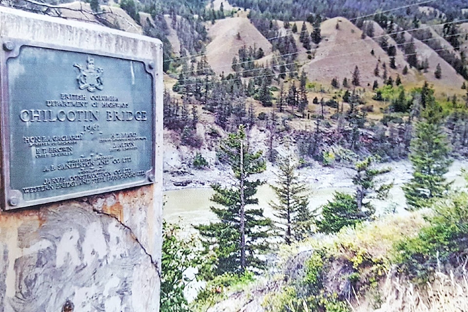
The new bridge opened officially in September 1962, almost exactly 58 years after the old one had gone into serviced. This new bridge was officially named the Chilcotin Bridge, but, as with its predecessor, it still goes by several different names. For nearly 60 years now this bridge has been a reliable, safe crossing as well as the major access point to the Chilcotin country. It is scenic and often photographed, and it stands as a testament to the strong work ethic and tough mindedness of those who opened up the west side of the Fraser River.
For this article, Barry relied upon the writing of Irene Stangoe and her book “Looking Back”, as well as photos from the collection of the late Dr. John Roberts, photos from the BC Provincial archives, and from the public domain website Williams Lake and Cariboo Chilcotin History. And you can see all these photos in this month’s edition of “Freedom 55” and/or the special publication Casual Country produced by the Williams Lake Tribune.