Barry Sale
Special to the Tribune
On the south side of the Quesnel River, seven miles to the west of Quesnel Forks, there lies a large tract of flat land with about a mile of river frontage. Sitting just above the high-water mark are two large rusting boilers. These are all that remain of the Texas Ferry crossing, where gold-seekers and pack animals once crossed over to the north side.
If you stand next to the boilers and look across the river, you see a steep slope rising from the opposite bank. This is Texas Mountain, the top of which is now the site of the Kemess Q R Mine. Actually, on the north side there are several mining operations of various sizes currently in production, and with the present price of gold, the whole area sees a good deal of mining activity.
The Texas Ferry crossing was established during the great Cariboo gold rush, when prospectors were flooding into the area. It was situated on a well-known Hudson Bay Company fur brigade trail leading from the town of Quesnel upriver to Quesnel Lake.
From there, the trail went south to Bridge Lake and eventually led to Fort Kamloops. After the gold rush town of Quesnel Forks was created, this route was improved from both directions to facilitate the flow of men, pack animals and supplies to the hungry miners at the gold diggings.
Opposite Texas Mountain, a perceptive entrepreneur saw the potential of charging gold-seekers a fee to cross the river at that point and he brought in the two boilers and a steam engine to power a large winch. He strung a cable across the river, and through a pulley anchored on the other side. He then built a log raft, topped with hand sawn boards, which could be winched back and forth across the river.
This crossing served as one of the access routes to the Cariboo gold fields for several years. The acreage around the ferry crossing proved to have excellent growing land and soon a substantial farm was developed there supplying meat, vegetables and grains to the newly formed settlements to the east. In all likelihood, it would have also had a saloon and stopping house for the convenience of travellers going to and from the goldfields.
The influx of prospectors and fortune seekers had largely ended by the early 1870s but the towns of Quesnel Forks, Keithley Creek as well as several land rock mining operations continued on. Following the white placer miners were the Chinese, who reworked the river benches, the gravel bars and the tributaries up and down the major rivers.
Some of the old-timers around Likely vaguely remember a tale about a murder at the Texas Ferry area around 1875. It involved a white miner who had gone broke looking for gold. He came across two Chinese men panning gravel on the riverbank. He tried to rob them, but they resisted and he shot them both, taking with him less than an ounce of gold. Then the murders were discovered, a posse was formed and the culprit was tracked down and arrested. He was sent to the provincial jail in New Westminster, where he was tried, found guilty and hanged.
Chinese prospectors remained in the area for many years, eking out a living on the streams and rivers until the outset of World War 2. The last Chinese miner at Quesnel Forks, Wong Kuey Kim passed away in the winter of 1954. He froze to death walking home from a trip to Likely for supplies.
In 1892, there was a big mining resurgence in the region when the Bullion Mine bought up a large number of claims and began constructing the infrastructure to service what would become the largest open pit mine in the world at that time. The huge hydraulic operation went into fall production in 1899, and with over 200 employees and a company town called Bullion City, it added a huge economic boost to the Cariboo.
The old pack trail from Quesnel was expanded and became a regular supply route to the big mine. It was renamed the Quesnel-Hydraulic Road. The demand for the ferry crossing, however, continued to diminish, and after the Bullion Mine closed in 1907, the farm and the ferry operation were abandoned. Over the next several decades the place saw some squatters and some limited placer activity on Morehead and Jackpine, the two creeks in the area, but there was no sustained habitation.
In the early 1970s, a back-to-the-land movement of young people from both the United States and Canada was taking place. A young investor, John Coplin, rediscovered the 203-acre property and purchased it for $37,500 from the estate of George Gasker. Gasker had owned the place for a number of years and had lived a hermit-like lifestyle there. Surprisingly, he had very little interest in gold, preferring to dabble in pottery. He died in his cabin on the place in 1969.
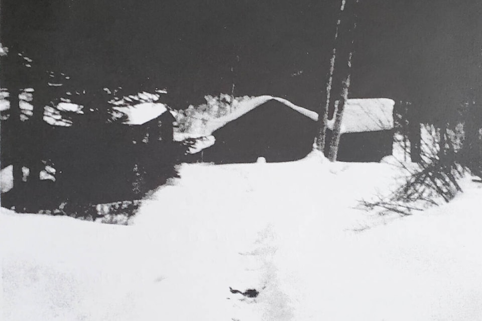
John Coplin opened up the land to some of his friends and two small compounds were created about a mile apart. A number of young people came to homestead there, setting up a communal lifestyle of living, repairing and restoring the old cabins, gardening, hunting, putting up hay and generally living off the land. As well, a number of young transients came and stayed for varying lengths of time before moving on. The people who lived at the place called it the Seven Mile Ranch, but the locals in the Likely area called it “the hippy place”.
In 1975, heavy rains caused a huge mudslide and devastating flooding. The river was completely blocked for a while before resuming its flow. Many of the improvements to the place and much of the newly-built infrastructure were destroyed. This was a catalyst – the long-term residents began moving away, many of them resettling and raising families in the area. A few stayed longer, but by the mid 1980s the Seven Mile Ranch was abandoned. Coplin sold the land in 1985 to Charlie Gainer, a logging contractor and resident of Likely. He logged the marketable timber then left the land alone.
In 2002, Gainer sold the property to Keith Richardson, an American investor who resides in Hawaii. Little has been done to the place since that time, although in 2010 or so, there were Chinese interests working the land in search of gold. The site is now chained off with no public access. Remnants of the old cabins, a few old pieces of equipment and a multitude of depressions in the ground where the gold exploration took place are all that remain. The land is still slipping, and in the summer of 2021, more mudslides took place.
It’s a piece of the Cariboo that is quite typical of B.C. gold rush history, having changed over 160 years from unsettled wild land to a place which provided business and agricultural opportunities to astute entrepreneurs, and a site where young homesteaders looked to fulfill their dreams. Now, it has largely reverted back to its natural state. Humans may come and go, but nature continues on.
My thanks to Jim Gibson of Likely and Rick Matthews of Williams Lake (who was there in the 1970s), for their assistance with the article. The pictures are courtesy of Rick.
READ MORE: HAPHAZARD HISTORY: History buff heads for Alberta in August
READ MORE: HAPHAZARD HISTORY: William Parker and the Big Lake Ranch
Do you have a comment about this story? email:
editor@wltribune.com
Like us on Facebook and follow us on Twitter.